Integrated Tech that Powers a Safer, More Connected Ole Miss
About the University of Mississippi
The University of Mississippi, commonly referred to as Ole Miss, is a flagship institution with a vibrant community of more than 20,000 students located in Oxford, Mississippi. The university is committed to delivering a digital experience that is welcoming, intuitive and connected and has thus partnered with Concept3D for over a decade to power a safe, inclusive campus.
Before partnering with Concept3D, Ole Miss relied on homegrown and outdated digital tools to serve its campus.
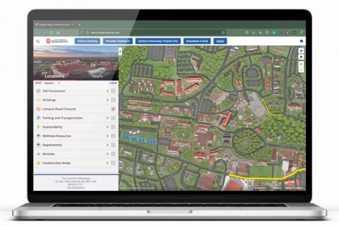
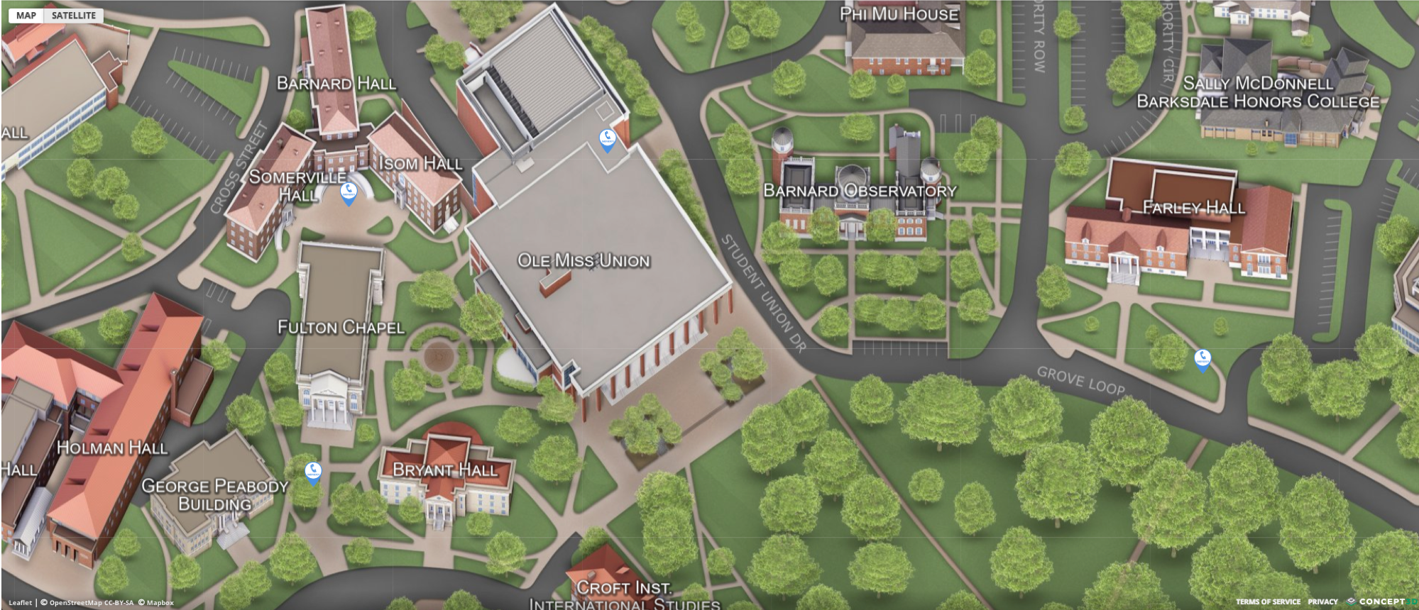
- The campus map started as a flat parking diagram that then progressed into a Google Maps mash-up built and maintained by graduate students. Updates were complicated with high turnover, errors were common and accessibility was almost nonexistent.
- Events were scattered across campus in silos, managed in Outlook calendars, department pages, or one-off tools. Students had no single, centralized place to discover what was happening on campus.
“It was very difficult to make updates or changes,” recalled Robby Seitz, Webmaster at Ole Miss. “Some of the information wasn’t even accurate. There were stores on the map that didn’t exist, and accessibility? It wasn’t even addressed.”
Discovering an Integrated Solution: Concept3D Map + Localist Events Calendar
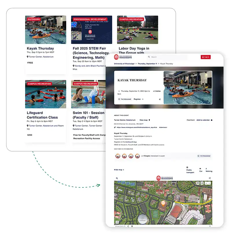
In 2012, Ole Miss adopted Concept3D’s Interactive Map which became a polished, professional tool for wayfinding, safety management and student engagement. After 10 years of trusted partnership, the university added Localist Events in 2022 to address its longstanding challenges with decentralized event promotion.
“We onboarded Localist at the perfect time and it’s really driving more people to one campus calendar that integrates with our campus map. It’s been a great tool that has bridged the gap between two strategic projects [Website and ERP] of the highest priority,” Ryan Whittington, Assistant Vice Chancellor for Marketing said.
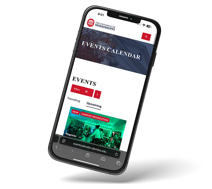
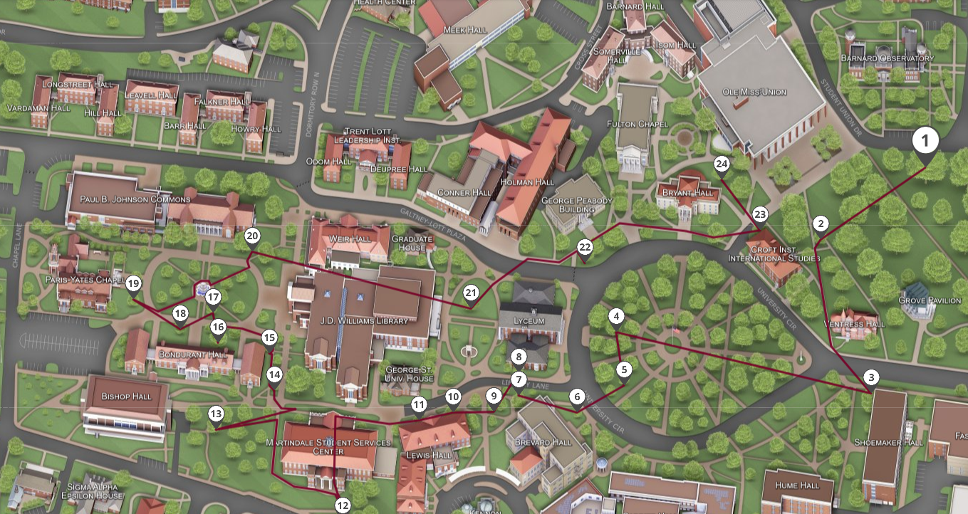
The real transformation came when Ole Miss embedded the Interactive Map directly into Localist Events. Now, every event listing connects seamlessly to locations on the map, helping students, families, and visitors discover events and find their way there.
“Being able to embed the campus map in Localist is a game changer,” said Whittington. “It means more eyes on strategic locations and solves the challenge of, ‘Where do we point people?’ We already have one answer because it’s built right in.”
For Seitz, the integration simplified internal operational management:
“Only one company to go to. One vendor, two products, and both are best in class. That makes our lives easier.”
Safety & Accessibility: Beyond Wayfinding
For Ole Miss, the Interactive Map has additionally become a vital resource for campus safety, accessibility, and inclusion.
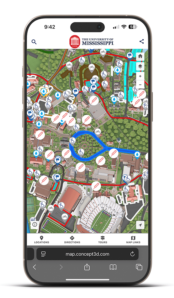
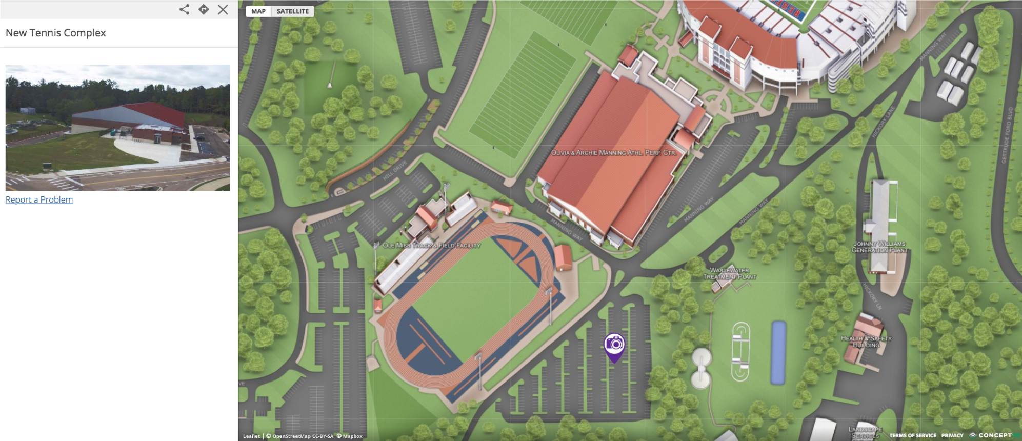
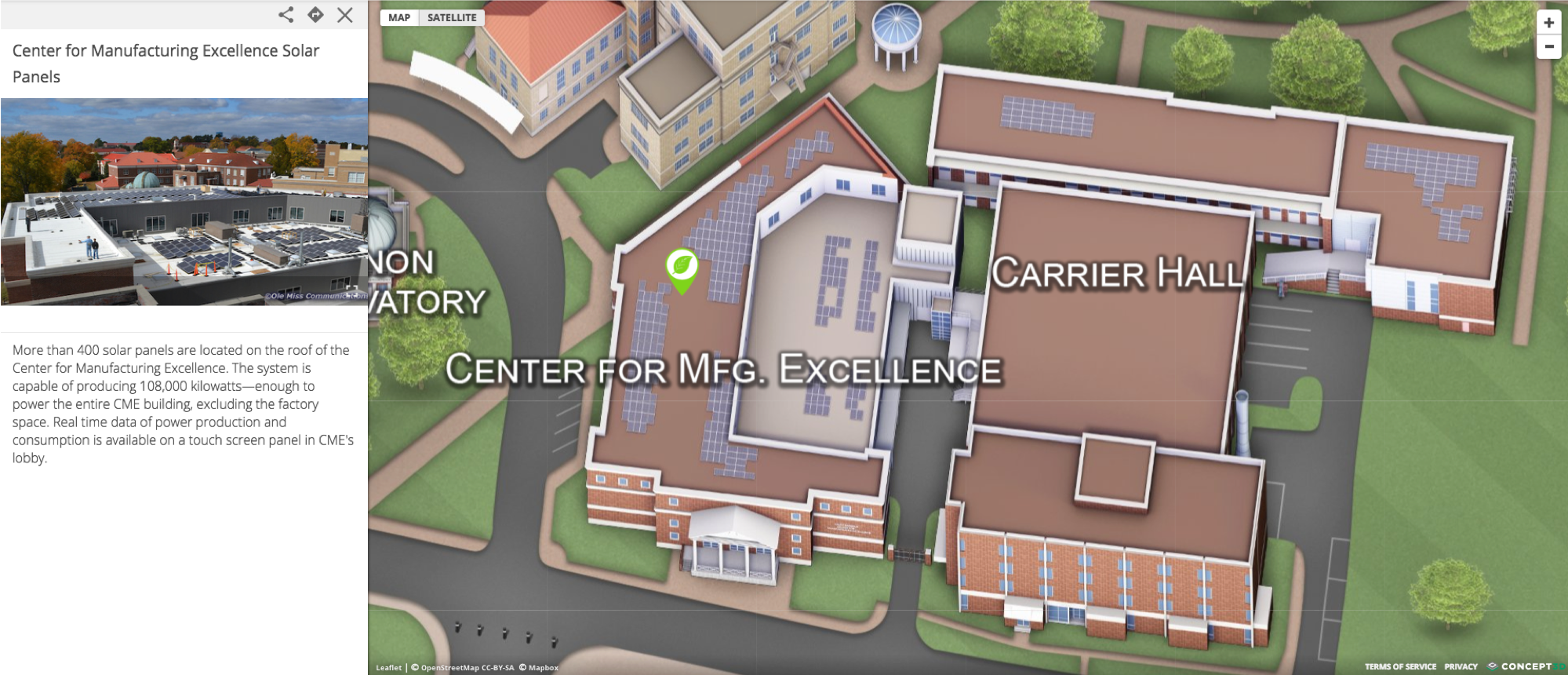
- 🚨Emergency Response: “One of the most popular features I hear about is parking,” Seitz explained. “But one of the biggest use cases came from our fire department. A few years ago, someone literally went around with a GPS device marking every fire hydrant on campus so they’d know exactly where to connect in an emergency. We added all of that to the map, and it’s been incredibly valuable.”
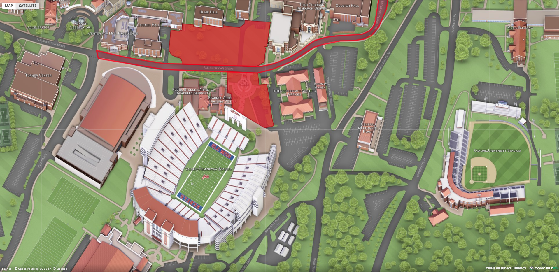
- ♿ Accessibility: Concept3D’s suite of tools also help Ole Miss meet digital and physical accessibility goals. Wheelchair-accessible entrances, campus pathways, ADA compliant parking locations, etc are centralized in one place—something the university simply couldn’t provide before digitally.
- ❣️Student Wellbeing: When a student-run organization began distributing free period products in campus buildings, they needed a way to share the locations quickly and to the broader student body. Whittington recalls: “We created a new layer on the map. They thought it would take months, but we had it done in a couple of hours. It was the perfect way to support a student’s need with a campus-wide solution.”
“At the end of the day, our purpose is to serve students,” Whittington added. “Why wouldn’t we create a space where everyone feels welcomed and supported?”
“I doubt our old maps were accessible in anybody’s definition of the word. Now, Student Disability Services tells us this is actually really helpful.”
Robby Seitz, Webmaster

- Recruitment & Retention: Prospective and current students can explore events and campus life in one intuitive place.
- Operational Efficiency: Quarterly update cycles and collaborative governance ensure the map is kept accurate and information is being collected from cross-functional departments.
Perhaps most telling is what happens every August.
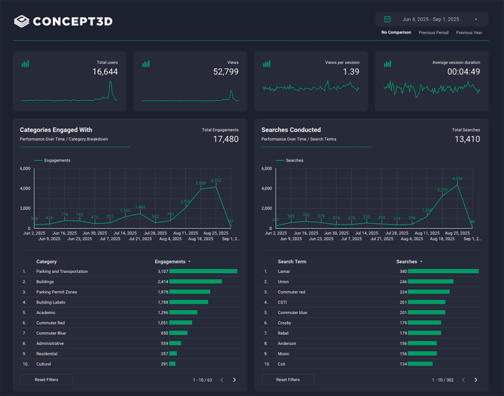
“The biggest indicator is the spike in traffic to the campus map during the first week of school. That tells us students are using it exactly as intended. It’s their one-stop shop.”
Ryan Whittington, Assistant Vice Chancellor for Marketing

Ole Miss has worked with Concept3D for more than a decade, a rarity in higher education vendor relationships. Both Whittington and Seitz emphasized the steady, responsive support they’ve received.
“It’s like we’ve raised a child together,” Whittington joked. “We’ve been through so many updates and evolutions, and the relationship has stayed steady the whole way.”
Seitz summed it up simply:
“The length of the relationship speaks for itself. We like the company, we like the products, and we don’t want it to change.”
Ole Miss continues to explore new features within the Concept3D suite, from detailed athletics venue layers to expanded wayfinding. The partnership remains a cornerstone of their digital strategy.


Transform your online experience.
See our technology solutions come together in one seamless experience.