How Colorado Convention Center Leads the Herd of Visitors
 Helping visitors easily navigate the Colorado Convention Center
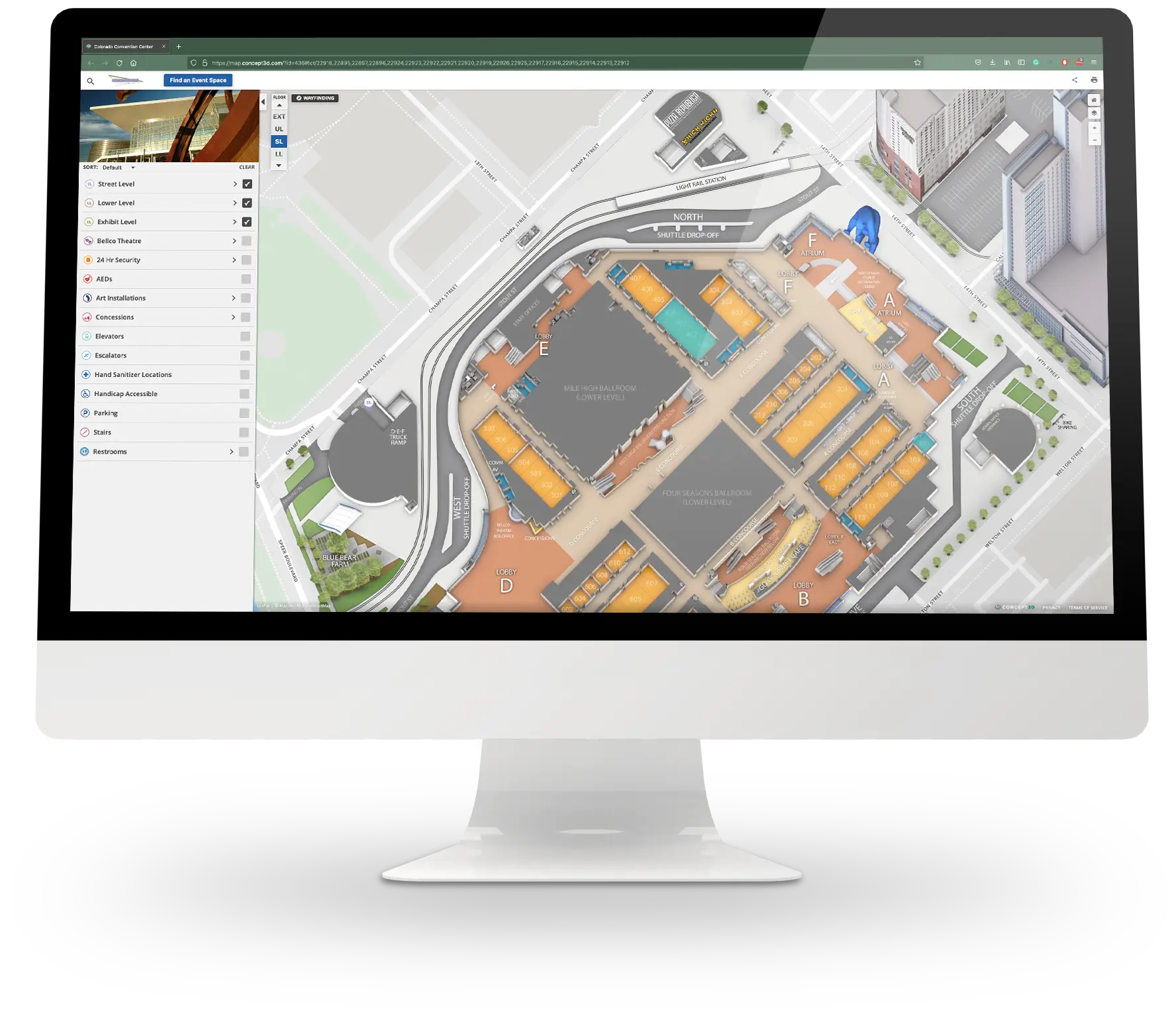
The Colorado Convention Center is a hub for events in the heart of Denver, Colorado. As Rich Carollo, the Director of Sales & Marketing knows, there’s a conference for everything, and the convention center caters to all sizes of events, big and small. However, the sheer size of the convention center and the confusion of downtown made the team realize they needed an interactive solution to get visitors acquainted with the space, internally and externally. That’s where Concept3D comes in.
“Anything you can think of, there is a conference or meeting for. Literally.”
Rich Carollo, Director of Sales & Marketing
Home to 250 events annually, the Colorado Convention Center thrives in its 584,000 square feet and maintains its goal of bringing awareness to the facility, its events, and selling tickets. It’s all a part of making the Denver experience that much more enjoyable.
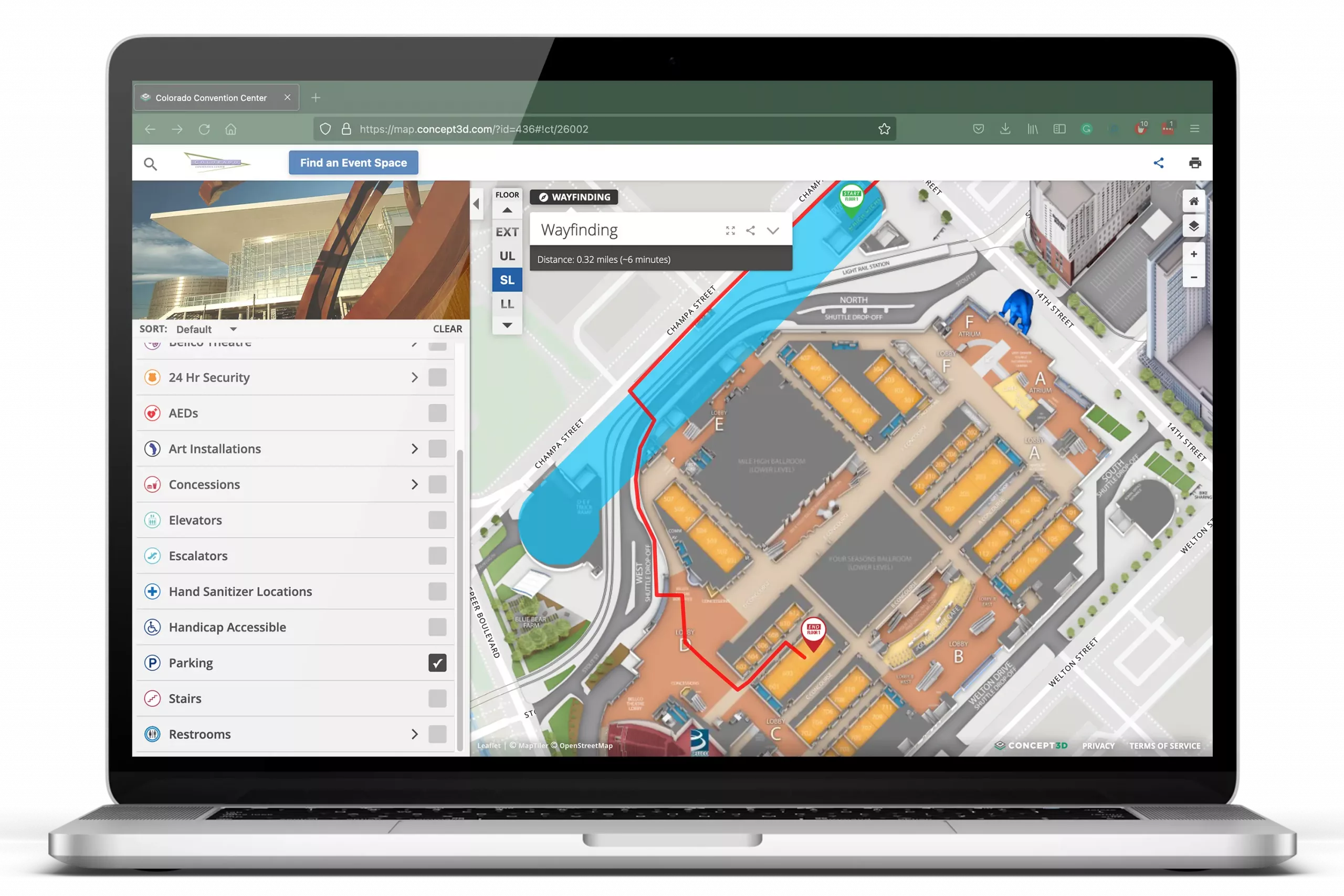
Because of the large space, Carollo and his team knew they needed a virtual mapping solution. They needed to help people get from point A to point B both externally and internally, providing the best customer experience possible.
“We’re challenged with peoples’ inability to adapt when something doesn’t work out for them, and just showing them where the rideshare ADA drop off is, the relationship from the parking garage to the theater.”
Rich Carollo, Director of Sales & Marketing
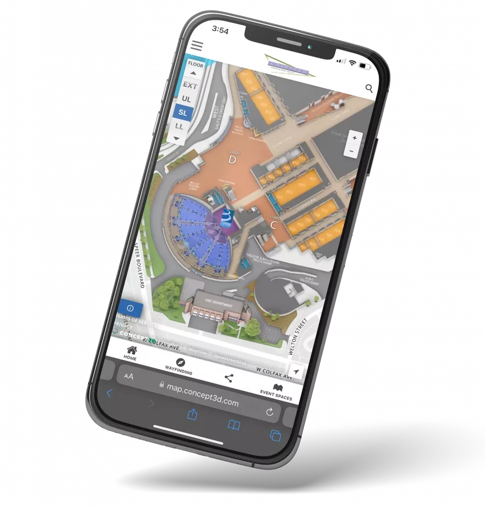
In 2017, the team decided to switch over to Concept3D’s Interactive Map. It was the perfect solution for The Colorado Convention Center; the user interface is fresh, modern, and there’s tons of flexibility on the back-end. It also provides just what the team was looking for—internal and external bird’s-eye views of the convention center.

Since implementing their map a few years ago, the team at the Colorado Convention Center uses their Interactive Map in a variety of ways. Firstly, they’re getting people from point A to point B just like they wanted to with wayfinding. Secondly, they can clearly label parking, rideshare, and accessibility route information for event-goers who need to navigate downtown Denver. Lastly, Carollo and his team love the ability to integrate 360° panoramic photos to event spaces to give attendees an idea of what the space will look like.
“I love the panos, I love the idea behind it. In the past in our industry, before all the fun technology came out, in order to show various things, you literally had to change every room set and retake every picture, and that’s an incredible amount of labor and time. You made the process so much easier.”
Rich Carollo, Director of Sales & Marketing
Their Interactive Map has helped the Colorado Convention Center increase their client satisfaction with up-to-date event information. Since using certain parts of the map as a “know-before-you-go” marketing tool in emails, they’ve noticed people are more comfortable with the event space. Event-goers can come in already knowing which rooms are best for what and where important areas around the center are.
“I’m using the map as a sales tool in a way to orient people to where they’ll be in my facility to give them a look of the rooms and how all those things lay out. It makes people comfortable.”
Rich Carollo, Director of Sales & Marketing


Transform your online experience.
See our technology solutions come together in one seamless experience.