With college and professional football back in action, and baseball playoff season ahead, sports stadiums are as crowded as ever. In recent years, Americans have spent around $56 Billion to attend sporting events. To put that in perspective, it’s more than double the $27 Billion Americans spent on buying books.
And everyone can agree, attending a sporting event is fun for the most part, but there are always a few setbacks. Parking? Took forever to find the right lot. Food? Had to walk all the way over there, wait in line, and couldn’t find the right snack….
If you’re looking for other ways to improve the fan and guest experience, you should read our blog ‘5 Ways to Improve the Fan Experience’.
At Concept3D, our interactive maps have proven their utility in helping make game day a whole lot easier for fans and organizers alike. Here are a few ways that interactive maps are improving the overall game day experience:
Parking
Sometimes finding parking is an absolute disaster. Especially in crowded lots where there are thousands of fans flooding the same exact place. And, of course, no one wants to spend their time searching for and figuring out parking when they can be inside the stadium enjoying themselves.
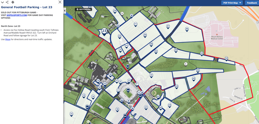
Interactive maps can be used to show people exactly where to park, information on pricing and restrictions, rideshare drop-off and pickup locations, and real-time data feeds can even show lot occupancy how full the lot is – essentially taking the stress out of parking. For example, Penn State University categorizes their parking maps by sport – Gymnastics, Lacrosse, Soccer, etc. Once the sport category is selected, the map highlights the specific parking lot near each stadium. From there, driving directions and additional information about the lot or garage is easily accessible to interactive map users.

Day-of Activities
Whether it be tailgates, merchandise shopping, concessions, or live music, there’s always a fun activity happening before and after the game. Make it simple for fans to find pre- and post-game celebrations with an interactive map.
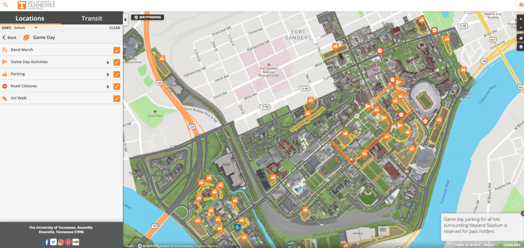
Static maps can give people the plain and simple facts – where an event is and what the event is called. But with interactive maps, stadiums are able to show actual images of the grounds to give people a real feel of the event. The University of Tennessee has a specific “Game Day” tab within their interactive map, which lays out all of the activities occurring throughout the day. One of the tabs labeled “Marching Band” even highlights the route the band will be marching, and the time it will begin. This makes it easier than ever for fans to plan out their day accordingly.

Where to Eat
When it’s time to indulge in a snack, most people find themselves walking in circles around the stadium to find exactly what they’re craving. And then once they find the right sport, they spend precious game time waiting in line for their food and drinks. Interactive maps can not only display all of the different options fans have for food and drinks at the game, but maps have live data feeds integrated to show wait times at certain stations or restaurants. These features can help direct stadium goers to the correct concession stand and lessen congestion in certain areas.
Additionally, point-to-point wayfinding technology can be integrated within the map to ensure easy walking directions around the grounds of stadium or campus. All maps are readily accessible from a mobile device, and even allows visitors to drag and drop pins so they can make it back to their seats without navigation confusion. Putting an end to wandering aimlessly.
Driving Directions
Although Google and Apple maps directions may suffice, our interactive maps lay out specific routes that ensure the easiest and quickest way to get to and from the event. Use the point-to-point feature to simply send directions to friends or family that are tagging along for the game day festivities.
Interactive maps allow you to waste less time, parking, walking, or waiting in lines, and more time to watch the actual sporting event.


