Convention centers are the canvases for events ranging from national trade shows to galas and top meetings with Fortune 100 CEOs. With event and meeting planners always on the lookout for the next best space, and so many people coming in and out of a convention center every day, having a detailed yet easy-to-use map is essential. Powered by the Concept3D platform, Hawaii Convention Center’s interactive 3D map provides that and a whole lot more. The map combines wayfinding, the ability to virtually “jump” into a room and around the exterior, and highlights all the amenities of the convention center in amazing detail, all provided by the Hawaii Convention Center’s team of professionals.
The Hawaii Convention Center is the State’s largest meetings facility, with a massive 1.1 million square feet and some very unique and gorgeous meeting and breakout spaces. With the interactive map, each floor of the convention center is easy to access and see the different options available: exhibition space, meeting rooms, ballrooms, parking – even a huge rooftop terrace. The convention center’s interactive map has a navigation sidebar that allows users to toggle through each of these floors and the different rooms to access exactly what they’re looking for.
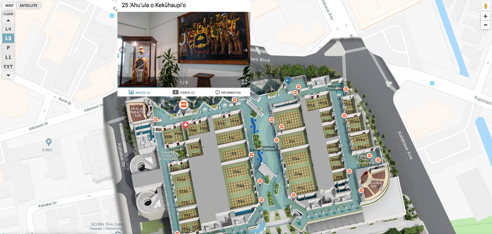
One of the most notable things about the Hawaii Convention Center is that when it was built in 1998, it was designed with a Hawaii “sense of place” by Hawaii-based architecture firm Wimberly Allison Tong & Goo (WAT&G) and LMN Architects. This style is accentuated by the extensive art collection – part of the Hawaii State Foundation on Culture and the Arts “Art in Public Places Program.” The art collection is brought to life within the center’s interactive map that shows all of the Hawaiian inspired artwork that is on each floor.
The Hawaii Convention Center’s sizable lobby features a 70-foot waterfall that sets the tropical tone for the visitor. This amazing experience is also visible on the 3D map.
Like a virtual tour, photos of the lobby and many other spaces in the convention center are available, so event planners and visitors alike can explore and know what to expect before arriving. The convention center also has the largest ballroom in the state, 47 meeting rooms, and a 2.5 acre rooftop garden. This landscaped rooftop is stunning and recreated in detail with Concept3D’s interactive mapping platform.

Convention centers are doing things differently these days, offering unique spaces that cater to many different events. For example, the Hawaii Convention Center uses its interactive map to profile its 28 volleyball and badminton courts, 18 basketball courts and 11 futsal courts – making it a great venue to host sports tournaments of all sizes. These courts along with the surrounding concession stands are not only located on its interactive map, but accompanied by photos of the courts as well.

Hawaii Convention Center’s 3D map is a tool that can be used by visitors, event planners and employees. For visitors, navigating a large convention center can be a challenge – especially if they are visiting from out of town. This interactive map clearly lays out each floor of the center, with all rooms labeled, as well as highlighting places to eat, restrooms, ADA accessible ramps and routes, and nearby hotels.
For event planners, the interactive map is designed to simplify the event planning process, because they can visualize and see spaces before ever setting foot on the property. And employees can also benefit from the map, not just for personal wayfinding in the space, but also to help lost visitors find their way.
It can be difficult to highlight all of your convention center’s style and assets online, but an interactive map is a powerful tool to bring it all together and put your best foot forward.
Explore Hawaii Convention Center’s interactive campus map: https://map.concept3d.com/?id=1107#!ct/25427,24748,24747,24709,24708,22261,0