Interior-to-Exterior Wayfinding Software
Find directions between two locations. Search for a map location or choose a destination.
Trusted by 675+ Institutions








What Sets Concept3D's Wayfinding Apart
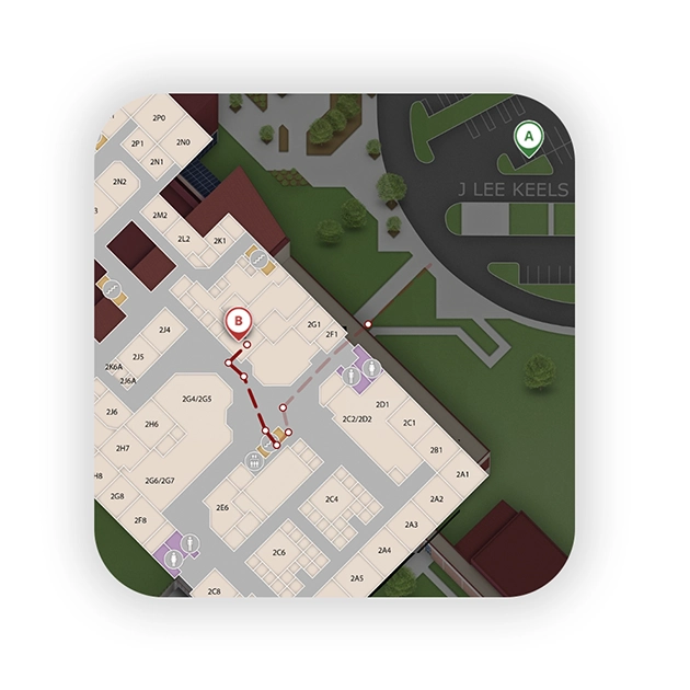
Interior-to-Exterior Wayfinding
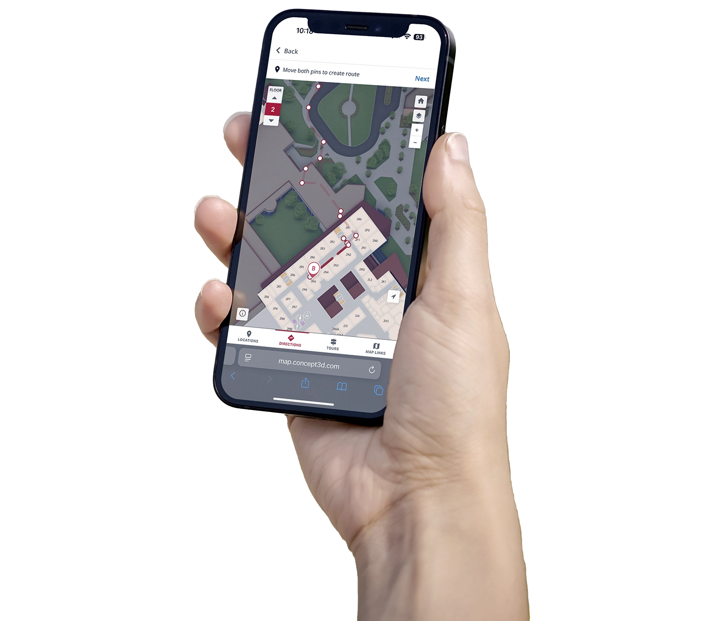
Guide visitors from their parking to a specific room inside a building
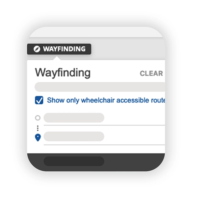
Accessible Routes
Make every destination easier to reach with clear, accessible routes designed for all visitors
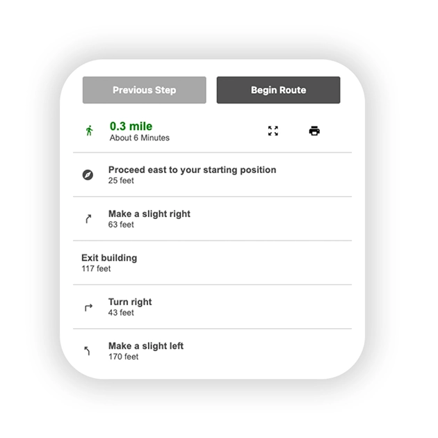
Turn-by-Turn Navigation
Guide visitors confidently to their destination with clear, step-by-step directions at every turn
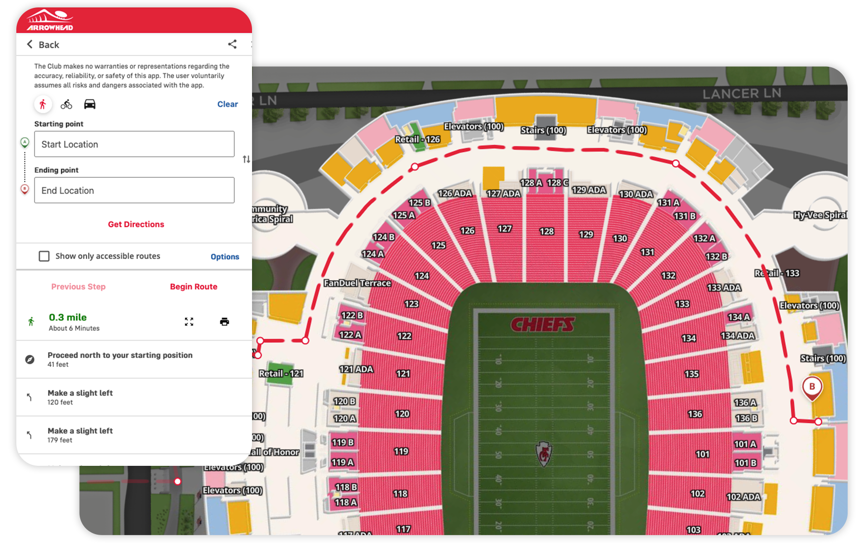
Large facilities like stadiums, universities, convention centers, resorts, theme parks, and other large buildings or campuses know the confusion many visitors experience. Seamlessly integrating outdoor and indoor navigation helps guide visitors through details like room numbers, stairs, restrooms, emergency exits, and accessibile routes. Concept3D’s wayfinding features empower visitors to find an intuitive path for themselves through 3D mapping.
Concept3D’s wayfinding system is defined by its flexibility.
Routes, best possible paths, accessible paths and turn-by-turn navigation are customized for each implementation through Concept3D’s content management system. Displaying how end-users access the directions, path, or route can be either through our Interactive Map or delivered via the Concept3D’s Wayfinding API.
Wayfinding through our interactive map is best for organizations that need an out-of-the-box turnkey wayfinding solution. If your navigation needs tend towards visitor experience including accessibility maps, custom public turn-by-turn directions for indoor navigation, or is mobile-centric then the platform is most likely the direction your company will want to go. If you need a complete customizable wayfinding and navigation solution then our Wayfinding API is the way to go.
Mobile-friendly wayfinding elimates navigation frustration
- Intuitive search allows visitors to find buildings and rooms quickly
- Drag-and-drop pins that let visitors customize routes and their experience through a simple user interface
- Wheelchair Accessible Route separate from the standard best possible route, the best possible route for a wheelchair
- Print-friendly customized indoor maps for printing in advance of a visit
- Point-to-point directions sent in a text message or email, within mobile apps, through digital signage
- Seamless integration from driving directions, linking from Google Maps to indoor navigation
Read Experiences From Our Partners

Jenny Carrick
Director of Marketing Communications
5.0 out of 5
“Data is critical for us to understand who our prospective and admitted students are, but it’s also highly protected. The integration with our CRM gives us the insight we need while allowing us to protect that data appropriately.”

Michael McDonald
Assistant Director of Digital Experience
5.0 out of 5
“Accessibility was the number one and number two reason we did this project. We had a moral, ethical, and legal impetus to provide better digital navigation for all students and visitors.”

Jen Brock
VP for Marketing Communications
5.0 out of 5
“What I really appreciated was knowing how deep your higher ed experience was. We didn’t have to explain certain things like how complicated campus communities can be or why accessibility was important, that was all just understood.”

Thea Thompson
VP of Marketing & Communications
5.0 out of 5
“I would absolutely recommend Concept3D. I love the systems, I love how they interact with each other… but also the service that comes with it, the support we get from the team, from implementation throughout, they’re always open to talk to us and I think that makes a huge difference.”

Ryan Whittington
Assistant Vice Chancellor for Marketing
5.0 out of 5
“The biggest indicator is the spike in traffic to the campus map during the first week of school. That tells us students are using it exactly as intended. It’s their one-stop shop.”

Dave Herringshaw
Senior Digital Production Specialist
5.0 out of 5
“During orientation, new students use the map for wayfinding and the calendar for personalized events tied to their residential community. But the impact extends beyond students. Families and alumni also use them for reunions, commencement, and more. The map and event calendar improve attendance, reduce confusion and create a smoother experience.”

Annie Cline
Senior Director of Interactive Media
5.0 out of 5
“It’s just the simple and seamless integration of being on an event, and you scroll down and see the map that you’re used to seeing elsewhere. It’s not jarring. It all looks the same and it just makes sense.”

Dave Van Etten
Accessibility Consultant
5.0 out of 5
“Partnering with somebody like Concept3D that already has the accessibility built in solves a huge problem for us.”

Robert Buttner
Web Content and Compliance Manager
5.0 out of 5
“Flat out, we would not be a customer if the platform wasn’t accessible. The legal landscape is quickly catching up, and it’s not a ‘should do’ anymore, it’s a must. Concept3D stood head and shoulders above the other products we evaluated.”

Sean Ferguson
Director of Marketing
5.0 out of 5
“I love the fact that someone can pull up the map on their phone, see their blue dot, and walk around campus knowing where they are in real time. That’s very different from anything we’ve had before”

Steve Edwards
Senior Director of Marketing
5.0 out of 5
“The ability to create custom views, show specific locations for different audiences, and integrate it into our admissions strategy makes it a much more flexible tool.”

Christopher Judge
Live Event and Multimedia Producer
5.0 out of 5
“Using Concept3D’s mapping service became integral to how we executed this self-guided tour. The flexibility we have to print the map, embed it on native providence.edu pages, and even integrate Spotify tracks directly within the location descriptions gave us the ability to meet prospective students wherever they are.”
Frequently Asked Questions
What is digital wayfinding?
Digital wayfinding helps people navigate your location using an interactive digital map. Instead of relying only on static signage or printed maps, users can select a destination and receive a recommended route with turn-by-turn directions. Digital wayfinding can be especially useful across large or complex environments such as college campuses, hospitals, stadiums, and other large destinations.
Is Concept3D's wayfinding beaconless?
Yes. Concept3D’s wayfinding does not require physical beacons to provide routes and directions. Users can select their starting point and destination within the Interactive Map to generate a route.
How does Concept3D's wayfinding work?
Concept3D’s wayfinding connects locations within an Interactive Map using a web of nodes to generate turn-by-turn routes between a user’s starting point and destination. Routes can guide users across outdoor pathways and through indoor spaces, helping create a more seamless navigation experience across complex environments. Organizations can also provide different routing options, including routes optimized for accessibility.
Can your wayfinding generate indoor and outdoor directions?
Yes. Concept3D supports indoor and outdoor wayfinding, including routes that transition between exterior spaces and interiors. This makes it possible to guide someone from their parking spot to the room they’re looking for.
Can your wayfinding provide accessible routes?
Yes. Organizations can provide wheelchair-accessible routes in addition to the quickest available route. Accessible routing helps users avoid barriers such as stairs or steep inclines and guides guests to pathways, entrances, elevators, and other accessible infrastructure.
Is Concept3D's wayfinding digitally accessible?
Concept3D is designed with digital accessibility as a priority, including accessible navigation options within the wayfinding experience. Organizations can offer wheelchair-accessible routes while providing the broader wayfinding experience through an accessible digital map.
How can wayfinding improve navigation across a college or university campus?
Campus wayfinding gives guests and community members a simpler way to navigate unfamiliar or complex spaces. Users can select where they are (or use their device’s location) and where they want to go to receive a recommended route and turn-by-turn directions. This makes it easier to find academic buildings, residence halls, parking, athletics facilities, offices, and other campus destinations.
Can students and visitors get directions from parking to a specific room?
Yes. Concept3D can connect students from their parking spot, or wherever they are, to a specific classroom. Our wayfinding software can generate interior-to-exterior directions regardless of your campus size.
How can campus wayfinding help during orientation, move-in, commencement, and other major events?
Major campus events bring large numbers of people into spaces they may not know well. Digital wayfinding can give visitors an easy way to find parking areas, check-in locations, residence halls, event spaces, entrances, and other important destinations from their phones. Universities can also update routes and map information as traffic patterns or access points change for an event.
Can universities provide accessible routes across campus?
Yes. Universities can provide wheelchair-accessible routes alongside standard routing options. Accessible routes can account for campus infrastructure such as accessible pathways, entrances, and elevators rather than simply directing every user along the shortest route.
Can wayfinding account for construction, temporary closures, and changing entrances?
Yes. Digital wayfinding gives campus teams more flexibility than static maps or signage when routes change. Universities can maintain their wayfinding automatically as construction, closures, or changes to entrances affect how people should move through campus.
How can wayfinding improve the campus visit experience for prospective students and families?
Wayfinding can remove the most common source of friction from a campus visit: figuring out where to go next. Prospective students and families can use an interactive map to navigate between parking, admissions, tour stops, academic buildings, residence halls, and other destinations. By making campus easier to explore, wayfinding allows visitors to spend less time figuring out directions and more time experiencing the campus itself.
Seeing is believing.
See our technology come together in one seamless experience.