Real estate professionals have access to a variety of technologies that can help showcase properties, pique interest about new neighborhoods, and improve the overall customer experience. Geographic information systems (GIS) that allow detailed interactive mapping of different environments have risen to the top of these resources.
Concept3D’s interactive 3D maps are a tool that can benefit both real estate agents and buyers. Real estate agents can showcase all of the various homes they have available for sale in a certain area and home buyers can use these maps not only to see the houses for sale but explore the areas and communities around these homes.
Real estate maps allow agents and agencies to easily showcase all of their available homes on a single place. Rather than using a third-party application such as Zillow, where potential buyers can see all of the homes for sale in an area, regardless of the agent.
Concept3D’s software allows agents to upload high quality images and videos onto a map so visitors can select a specific home to view these images and can see other information such as listing prices and contact information for the property.
This allows potential buyers to explore and get an in-depth look available homes before ever visiting the site in person. This transparency saves both the buyer and seller time and money by allowing users to get a feel for the location from anywhere in the world. With this knowledge it helps weed through potential buyers and encourages those interested to take next steps in reaching out to real estate agents.
Real estate maps can easily be updated and developed as the surrounding communities continue to grow – showcasing the shops, restaurants and activities that are flourishing in the area as well as walkability and other selling points.
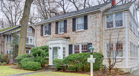
For example, Sotheby’s International Estates uses the Concept3D platform to showcase all of their properties for sale in the greater Rockville Center, New York area. All of DGSIR’s listings are shown on the map with beautiful photos of all of the homes they have listed as well as a brief description of the property and information on who to contact if interested in checking out the home.
However, beyond just showcasing their homes for sale, Sotheby’s uses their map to demonstrate why homeowners would want to live in the area. The map has things to do in the area, schools, community events, religious institutions, and other features that set this area apart from others, making it a great place for families to live.
This is just one example of the many ways real estate agents can use mapping technology to sell homes and keep customers happy.

