Every now and then, an idea emerges that can transform the marketing of an entire industry. At this moment, we are witnessing the growth of such an idea in higher education.
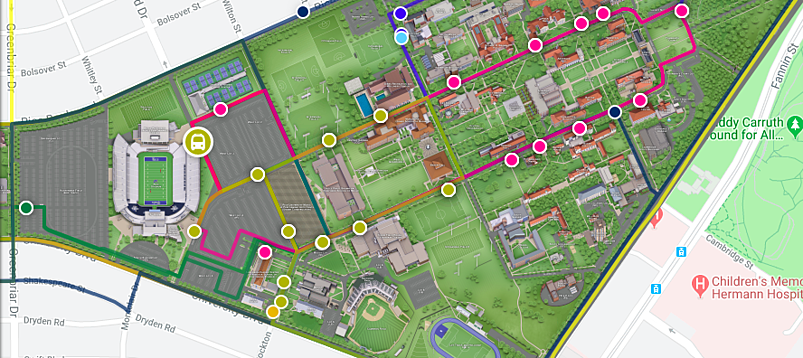
Campus maps have been around as long as universities. We all remember (and still receive) those printed maps to help us find the right building, whether it be for an admissions tour or a return visit for homecoming. In the meantime, the concept of mapping has evolved far beyond those simple print-outs.
Today, universities across the United States and the world are using digital maps as the starting point for immersive, virtual VR tours. They build multiple layers on each of their maps to make them more relevant for individual audience segments. And, perhaps most importantly, they’re beginning to build live data integration into their mapping systems.
The Core Idea of Live Data Integration in Campus Maps
The basic concept is simple. You feed real-time information into your digital map, which takes it from static to dynamic. By integrating that data into your map, it becomes more actionable and more relevant to anyone who’s looking. That, in turn, makes the map itself (as well as any secondary features, such as virtual tours) more valuable and more likely to be used by various audiences.
Those benefits are not just theoretical. Today’s internet users are looking for more customized, personalized solutions in all aspects of their digital lives. Research suggests again and again that more personalized and relevant content can be the difference maker in getting your audience’s attention and gaining their trust.
That’s especially true in higher education, where marketers have long needed to connect with the variety of audiences in a complex environment. At once, your digital map serves students, prospects, and alumni. Your internal staff likely uses it as well. Through live data, you can optimize not just the map itself, but the campus community that depends and relies on it.
Solving Basic Wayfinding Needs Through Live Data
The most obvious uses of live data integration are already starting to make an impact on campuses across the United States. As we discussed in an article earlier this year, digital maps are beginning to transform the way we think about wayfinding at universities of all sizes.
Take bus routes as an example. On average, less than 50% of college students bring their car to campus, instead relying on public transportation to get around. Institutions like the University of Alabama uses sensors in buses to feed into its digital map, showing the real-time bus schedule at all times. It’s much easier to plan for getting to class on time if you know exactly when you have to be at the bus stop.
These capabilities extend to parking, as well. In 2017, Arizona State University won a national award for its college football gameday experience, in large part because of the way it enables visitors to plan for parking. Through its digital map, the university always lets visitors know exactly where they can find parking spots, and which lots are filled up. It’s easy to imagine how similar efforts during major events like Homecoming could decongest the campus.
The same can be true for unexpected events, as well. When an ice storm hit the University of Oregon in 2017, the campus safety office was able to use its mapping tool to provide real-time updates on the conditions of roads and walkways, including the ability to point out specific hazards and how to navigate around them. What could have been a logistical disaster turned into a sensible, straightforward communications tool.
As any campus safety officer or parking official will know, simply getting around on campus is one of the major challenges students experience. Optimizing both public transportation schedules and parking opportunities can play a major role in making your campus a safer, easier space to navigate.
Maximizing Resource Availability for Current Students
At the core of every university’s mission is the student. The success of your most important audience, in turn, often depends on resources that you cannot quite control. What you can do, though, is optimize the use of these resources in ways specifically designed to benefit your students.
Especially in an age of smartphones and tablets and with an increasing number of colleges banning laptops in class, open computer labs are rising in importance. But it’s still too common for students to make their way to get some homework done, only to find a lab with no empty space. Penn State’s new map uses live data to track usage of its labs, so students always know where to turn to.

The same principle can be applied to any other clearly defined use of equipment on campus. The data integration allows the institution to show not just the current use of the equipment, but couple that with usage trends that make it easier for students to decide when they want to leave their rooms. Even something simple like a live video feed of the intramural gym can help optimize your students’ days.
The same basic concept also makes sense in dining halls; tell your students when the food stations are busy, and they’re likely to wait until a less congested time. Everyone benefits, from your dining staff to the students themselves. And of course, being able to show the weather can be a simple but helpful addition for both current students and visitors.
Internal Opportunities of Dynamic Mapping
A large university serving thousands of students has to continually optimize its efficiency. Energy bills alone can range to the millions on an annual basis, making a major dent on a budget that has to be kept balanced, especially for public universities. Through live data integration, higher education can follow other industries in leveraging its mapping tools for much more than just wayfinding.
Warehouses and other industries are already using maps to track and optimize their energy usage. The same core principles can be applied in higher education, as well. And the applications don’t have to be drastic — something as simple as knowing when to turn the lights off in academic buildings can lead to major savings when considered over a long time frame.
Similarly, sensors can allow your maintenance personnel to track anything from water leaks to broken light bulbs. Your teams will know exactly where to go, and what to fix, minimizing downtime in the process. What seems like a minor issue on an individual level becomes significant once you begin to realize that campus safety has become one of the most important issues facing university administrators today.
Finally, you can even track your maintenance teams on campus, allowing you to optimize their routes. Just a week before commencement, knowing exactly how to best accomplish the landscaping task suddenly becomes a major challenge. With a map that tracks your teams, you can guide them to the right spots at the right time.
The Recruitment Opportunities of Real-Time Campus Maps
It’s impossible to overstate the importance of recruitment when it comes to institutional goals in 2019. In an age where high school graduate numbers are shrinking and competition is more fierce than ever, any opportunity to stand out from other universities can be the difference-maker in attracting students to your school. Live data can help to accomplish that goal, in more ways than one.
First, the concept itself can appeal to students and their families alike. An admissions visit tends to be among the most important decision-making factors for your students. If that visit is made easier because your family knew exactly where to park, you might just become more likely to consider that school. After all, by the time you bring your own car, you’ll want to be just as clear on what to do.
That’s not the only benefit, of course. Live data integration can be as simple as a Twitter or Instagram feed on a specific location of the map. Imagine seeing tweets from the Multicultural Student Center pop up just as you’re browsing the space, or an athletics feed just as you’re virtually exploring the stadium. If the goal of virtual tour is bringing the experience of a campus visit to your students, these types of social media integrations can play a core role in accomplishing that feat.
It gets better. Live campus tours typically happen intentionally during times when campus is not overly crowded, to avoid congestion. Imagine being able to leverage your digital maps (on visitors’ smartphones or installed kiosks) to show which areas tend to get the most traffic, helping to build a more complete picture of what campus will be like for students looking to imagine themselves there.
What Does the Future of Real-Time Data Integration Hold?
We’re just touching the surface of the significant possibilities that come with this type of technology. Implementing some of the basic opportunities above will already make your university stand out. Now, imagine what could be possible once you begin to integrate this concept with other opportunities we’re currently seeing on the rise.
Predictive analytics are among the most obvious opportunities here. Real-time data, combined with an archive of trend reports, allows for intelligence that enables your campus to not just present the present, but predict the future as well. From weather trends to transportation, this would allow a student to know exactly when the bus will be expected to arrive the next day, and plan their morning accordingly.
Similarly, it’s becoming increasingly clear to see the potential future applicability of sensors that transmit real-time data. These sensors might be able to track not just basic movement of major pieces such as buses or maintenance crews, but pick up secondary data designed to make sense of these major movements. Predicting inventory for dining halls is already possible in physical form — soon, students might be able to gauge the supply of their favorite meal before they enter through the same basic concept.
Getting to that future might still be a good time away. The key, though, is that many of the same basic concepts are already in use today. Universities who are jumping on the trend now are simultaneously positioning themselves to dig deeper into the same basic concepts. The beneficiaries will be students, alumni, and the university alike.
Building Your Campus Map to Account for Preferences and Differentiators
Every now and then, an idea emerges that can transform the marketing of an entire industry. Sometimes, that idea is based on a centuries-old concept but brings it into the future. That’s where we are with real-time data integration for campus maps today.
Getting started on this path means understanding your audience, and getting a good understanding of what their needs are. It means differentiating your map not just according to these audiences, but also in a way that makes your campus experience (physical and virtual) stand out from its competition. And of course, it means working with the right software to make all of that theoretical advantage a reality.
That process has to include using the right data mapping software. A digital map that makes this type of integration difficult or impossible will not hold up in an age where more universities are moving to live data every month. Set the foundation now, and build your future in leveraging this technology.
Concept3D’s expertise in higher education and real-time data integration might just be the perfect fit in this endeavor. We’ve built the Penn State mapping ecosystem, just as we partnered with Arizona State University on its award-winning parking solutions. We can bring that same expertise to your campus as you look to set yourself from increasing, and increasingly difficult, competition.