The 185-acre planned community located on Florida’s Amelia Island is home to the island’s last waterfront land available for new home construction. Crane Island’s property developers are using Concept3D’s detailed, interactive 3D mapping platform as a tool to showcase all that the island has to offer, and specifically to highlight the homes and home sites available.
Potential buyers can access the map from the Crane Island website and explore all of the available homesites. This provides an in-depth experience and view of the area so potential buyers can explore and get a feel for the location before visiting, and as a tool to encourage them to take the next step in the process.
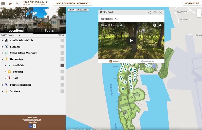
When a specific piece of land is selected on the map, visitors can view images and videos of the property from a variety of different angles. The map also provides important information such as the property listing prices. Different builders whom have already purchased and built homes on the island can use the platform as a way to showcase their houses that are up for sale.
As Crane Island begins to grow into a community, the interactive map for the island can be further developed to include more detail about the area and provide a variety of resources to visitors and locals. While the developments are just beginning, the interactive map acts as a great tool for both prospective buyers and property developers.
Topics: 3D Renderings, Share Your Place, Interactive Virtual Experiences, Content Management System