Emergency situations on campus are an unfortunate reality, but it’s always important to prepare for the worst and hope for the best. Emergency situations can come in many forms, a natural weather emergency, for example, can cause campus operations to come to a screeching halt. Having contingency plans for as many scenarios as possible is vital to mitigate the negative outcome of whatever emergency situation might grip your campus. A centralized source of information is key for both internal and external communications, and a great way is to use interactive campus maps for emergency planning.
What’s going on, where do services need to be dispatched, where should the student body be directed, and what should faculty be doing, are all questions that will likely arise. The first question, however, will be “where do I go to find information?” Creating inactive map emergency layers that can be activated if necessary offers the invaluable ability to provide a one-stop-shop source of information, and digital maps can also be updated with real-time information.
Informing Students
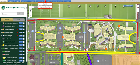
It is essential that all emergency communications to students are unequivocally clear, and being able to visually represent this information makes it easy. In a layer added to an interactive campus map, schools are able to display problem areas, detours, and information for students, faculty and staff regarding area and building closures or other needs. For example, schools located in harsher climate areas that see heavy snowfall can have layers pre-set to display in case of a blizzard. In instances of more severe weather events such as tornadoes or hurricanes, people on campus can be easily directed to the nearest shelter. In lockdown situations that include active harmers, students can be given clear directives to help keep them safe.
Learn more about CampusBird’s content management system.
Getting Campus Back on Track
Interactive campus maps can serve as a centralized source of information for faculty and staff as well. Teachers are able to see if any areas of campus are closed so they can plan around the situation, make more informed decisions and share important information with students. In lockdown situations, teachers can be given clear directions as to what actions should be taken.
Facilities managers can use the same map to coordinate all kinds of activity. And for those using Esri data, they can see anything from snow plowing to incredibly detailed facility-specific information. Campus security officers can use the map as a visual resource to get a better understanding of a situation and execute contingency plans.
Wrap-Up
Plan for the worst and hope for the best. If your campus is gripped with an emergency situation, the last thing you need is disarray or confusion and providing a centralized source of information through Campusbird is the easiest way to mitigate the negative outcomes of an emergency situation.
We hope emergencies never happen at your campus.