
We’re nearing the end of the spring 2022 semester, which for many colleges and universities brought a sense of normalcy. On-campus residency for students has begun to approach pre-pandemic levels, even if student engagement and enrollment challenges still remain.
Of course, the end of the semester also brings its own logistical challenges that schools have to reckon with. A sense of normalcy, in this case, means navigating the chaos and confusion that happens when the last final is submitted, commencement is finished, and your residential students are moving back home for the semester.
That means moving out of residence halls.
This massive logistical challenge typically requires close collaboration between multiple divisions, from student affairs to campus safety. At the same time, you also need the right tools to help your students and their families plan to make the day as efficient as possible.
That’s where interactive campus maps can enter the equation. The ability to build layers and categories, along with live data feeds, can play a massive role in streamlining move-out processes to help your students go into the summer feeling accomplished, rather than frustrated. Consider these 5 ways in which interactive maps can enhance the move-out day experience.
1. Create a move-out map category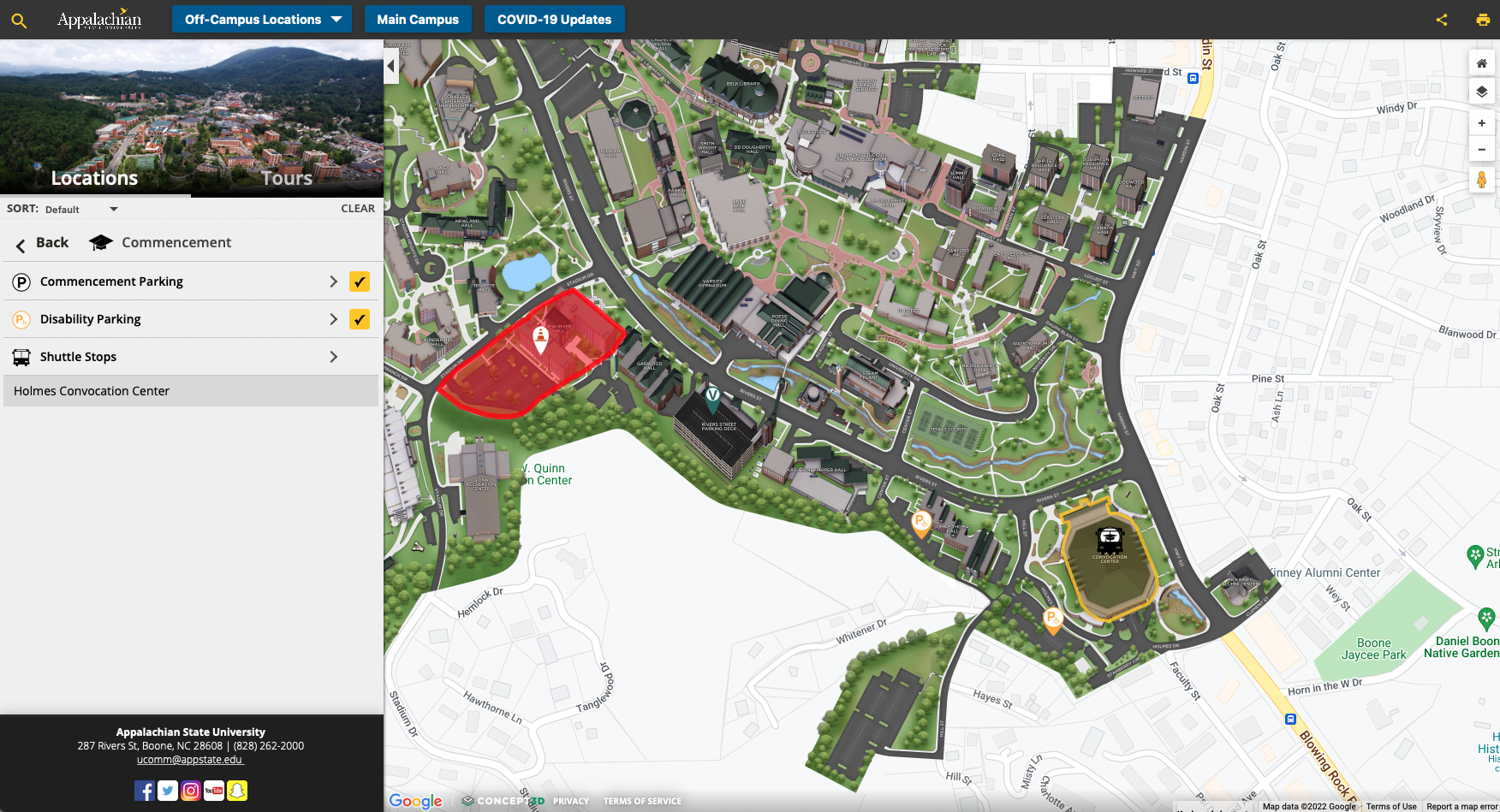
Similar to a move-in day category for your interactive map, a move-out category can easily communicate everything related to the big day within your larger map. In fact, most of what we’ll discuss throughout this guide should find its way into this category, which can provide a hub that your student affairs and residence hall staff can link to whenever needed.
More specifically, your move-out day category might include:
- Local storage opportunities for furniture that students don’t want or can’t take home over the summer.
- The parking lots your students and their families should use depending on the residence hall in which they live.
- Short-term parking and pick-up spots during a student’s assigned move-out time.
- Any important buildings for the move-out process, like key drop-off or room checks.
- Local hospitality opportunities, like hotels or bed-and-breakfasts, where parents helping their students move out can stay.
With a comprehensive category like this in place, all of your move-out day communications can link to a single spot. And of course, your interactive map allows you to get and provide easy directions to hotels, parking lots, and pick-up spots for parents and families.
2. Highlight local storage opportunities
Especially for largely residential campuses where students stay on campus beyond the typical freshman year requirement, they will begin to accumulate quite a bit of furniture over time. As more colleges and universities have moved towards more spacious, suite-style residence halls, students tend to fill up that extra space with couches, chairs, desks, and more.
But of course, they have to move out during the summer, and likely move into a different room in fall. For local students who can rent a moving truck for a day, that doesn’t tend to be an issue. But if finances are, or if a student lives further away, not all furniture may be possible to transport back home for the summer and back to campus for the coming fall semester.
That’s why local storage facilities who operate near college campuses tend to thrive. They often offer special summer rates for college students, allowing them to store their furniture rather than having to take it all home for just a few months.
Of course, your students and families also need to know just where those storage facilities are, and how they can easily reach them once they pick up the furniture from campus. An expansion of your interactive map beyond campus borders allows you to highlight these opportunities, along with directions that can show your core audience the right way and avoid traffic jams in town.
3. Build a walking tour to help students take the right steps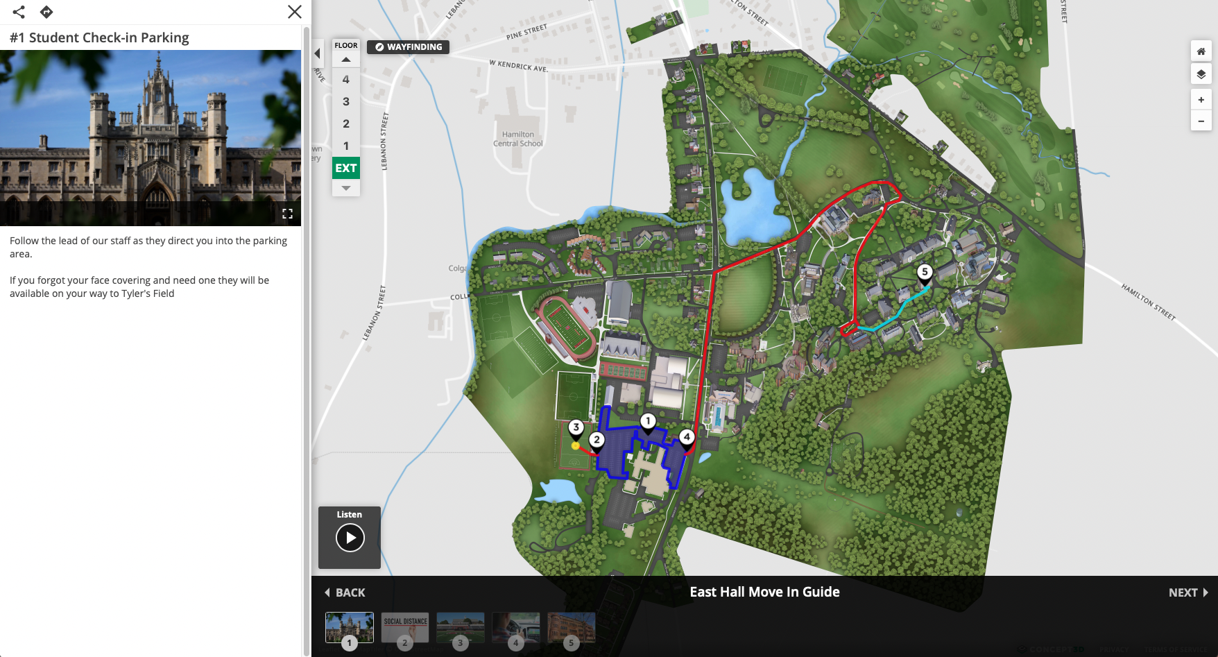
In addition to the more general move-out category on your interactive map, you can also build move-out tours. When designed the right way, these tours help students and families understand exactly what steps they need to take, and in which order to take these steps, to leave campus for the summer.
In effect, these map tours can look much like the sample move-in guide we have created on Concept3D’s Interactive Map. Whether they’re walking tours through wayfinding or paths that a car can take, creating a tour for each residence hall will help alleviate the stress of move-out. Your walking or driving tours should include the following:
- The pick-up spot for the residence hall in question.
- The key drop location where students can check out and officially sign off for the summer.
- The best or easiest route to leave campus once everything has been accomplished.
And, once again, direct links to both the tour and each individual step within it help to make the process easy for students and families. They can even share the directions to avoid any confusion when move-out approaches.
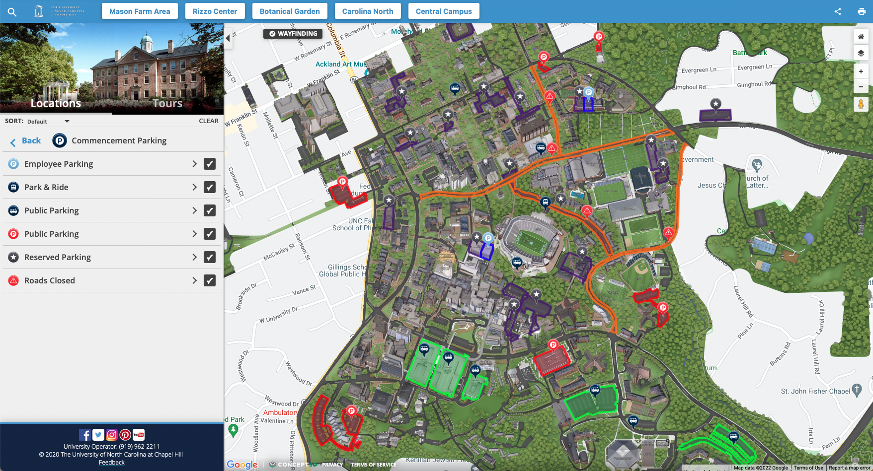
4. Outline campus pathways for parents and families
Of course, you can be helpful to students and families looking to go into summer with simpler ways than tours, as well. Especially for parents and families who may not be familiar with the ins and outs of campus roads and pathways, your interactive map can be a significant help.
The easiest way to accomplish that is by outlining the most popular or desired campus pathways to avoid traffic jams and clogs. For example, you might want to turn some of your roads into one-way streets on a day with this much vehicular activity. The right map layer can outline exactly what those pathways look like, creating an easier way to navigate around campus.
Finally, communicating your map to parents and families also helps them understand the broader context of campus, along with popular stops they might want to make. A long day on campus is likely made better if they know how to easily find a coffee shop or lunch spot while waiting to pack up and leave for the summer.
 5. Incorporate real-time data feeds
Finally, don’t underestimate the potential power of real-time data feeds to enhance your interactive map, not just for general audiences but specifically for your move-out day stakeholders. In fact, the right live data integration can both improve the user experience and solve potentially significant logistical challenges.
The most helpful kinds of data feed integrations include parking lot capacities and public transportation routes. On a day that will most likely have tons of visitors and traffic at your campus, your interactive campus map can be a great resource for those trying to decide which lot to park in or which bus to take.
Integrating real-time data feeds to your campus map can show updated parking capacity at each relevant drop-off location and parking lot, as well as where buses are in their routes. This allows parents and families to see exactly what times might be busier than others, allowing for easier planning that allows them to show up and help their student move out in the most efficient way possible.
Ready to create a better move-out day experience for your students?
No matter what, move-out day will likely be a stressful experience. However, you can make that process so much less stressful with an interactive campus map category specifically tailored for move-out.
It might be time to take a closer look at your interactive map, or find a mapping solution that allows for these steps to be implemented. Contact us to start that conversation. Or, check out our short demo to see how an Interactive Map can help in all facets of your higher ed institution.