Virtual and interactive maps are useful to just about any organization, business, or university campus for a variety of reasons. Here are some examples of specifically how virtual maps can enhance the experience of users both within and without any organization.
Emergency Services
One of the most important aspects of facilities in any organization or building is going to be where important and emergency services are located. For example, stadiums or indoor concert locations might have medical areas set up for there to be a place to go if someone is injured. Some beaches might have this set up as well. Obviously, it’s going to be highly important to quickly locate these services in the event of an emergency.
Interactive virtual maps will make it much easier to find such places quickly so that medical care and aid can be rendered quickly in the event that something happens. Certainly, ambulances may need to be called anyway, but many medical emergencies depend on basic aid being administered as quickly as possible in order to avoid tragic outcomes. Being able to look up where these centers are on a phone tablet, or other mobile devices can be a critical service.
This could also indicate exits for buildings, including fire exits. The prudent will always look up this information to be on the safe side when spending any substantial amount of time in a particular building.
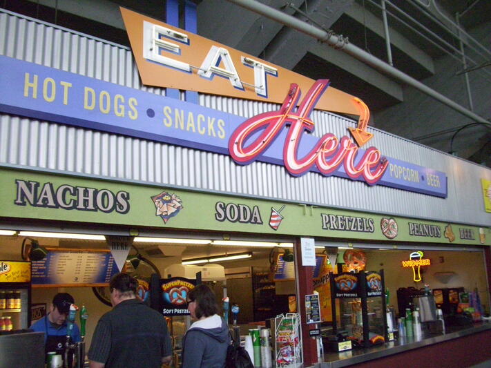
Concessions and Retail
Many organizations, whether they are a traditional service business or anything else, will operate in an environment where there’s an expectation of having food or shops somewhere nearby. Many places, such as concerts or meeting halls, are specifically for people who plan on spending a lot of time in one particular location, which is part of the reason for this expectation.
If an interactive map of the location is present, this will make it much easier for people and employees to keep track of where the major concessions are or where a shipping retail store is at a convention center. It is also often possible to combine other information and technology with this kind of map as well. For example, hours could be posted, as well as information about whether the store is even open in general.
But, an interactive map is able to handle this information more easily. Additionally, in the age of the Internet of Things, other info can often be added, including the availability of tables or even add availability of specific food items, such as whether they are available or in stock. Data about how long lines are and how long the wait is for each location can also be display on the interactive map as well.
Bathrooms and Other Related Information
Any building or location with significant access to the public and with a substantial expectation of high volume will need adequate bathrooms and other services like lactation rooms or mediation spaces. This is often the law and not just a good idea. The problem is that these can often be difficult to locate when you’re right in the middle of things, and trying to find the closest one to you is often going to be an exercise in futility without additional help. Customers and other users will often be highly appreciative of any interactive map that has the ability to get them to a bathroom in a hurry.
It’s especially the case that large crowds in large locations will make it even more difficult to try to locate signs for where bathrooms might be. And if you’re not close enough to one to see a sign, you could actually walk in completely the wrong direction for a while before you see a sign that gets you going the right way again. Families with children are hardly going to want to deal with an uncomfortable child while one of them wanders about helplessly, looking for their objective.
It’s also the case that bathrooms are often needed for other things other than the usual reason. For example, such a family may also need a changing station. Interactive maps could provide information about what kinds of extra facilities there are available at a location, so if they need a changing station, they can go right to the bathroom that has that. Plus, in certain situations it may be possible to set it up so that you use Information of Things devices so that a map can give out information about lines and wait times for bathrooms as well, this will also be a heavily appreciated service that will definitely endear users with the organization providing it.
In some instances, it could be more important than in others as well, such as if you’re out at the beach. This is because beaches often don’t have bathrooms, so you’re going to want to know which ones do and which ones don’t since the nearest bathroom could actually be a considerable distance away from you.
Plus, depending on the area and the service, it may even be possible to set it up so you can check on the map about whether the center has hours, and even whether there are personnel currently there.
Other Benefits
Obviously, there are a number of uses to interactive maps beyond those outlined. For example, you could list where trash receptacles are, which could be important for employees to know more than just customers. The Internet of Things makes it so that it’s often possible to tell which of those trash receptacles is full and when they need to be cleared, and this could be used in an internal map for a company or organization. Modern electronic maps also have applications for other areas such as security, allowing information about current situations to flow freely.
Overall, interactive maps can be tailored for almost any situation, and they truly are about as versatile as you might imagine. Plus, it’s likely that future improvements in technology will make the potential for these maps to be even more useful. The Internet of Things is exploding right now, and it makes interactive maps almost infinitely useful.