At Concept3D, we believe Interactive Maps are most impactful when they’re used not just for navigation—but for storytelling, accessibility, engagement, and discovery. Each year, we recognize partners who push the platform forward and show what’s possible when digital wayfinding is designed with intention.
This year’s Interactive Map Partner Award winners exemplify creativity, innovation, and a deep understanding of their audiences. From immersive storytelling and student recruitment to inclusive design and historical preservation, these partners are redefining how maps can serve their communities.
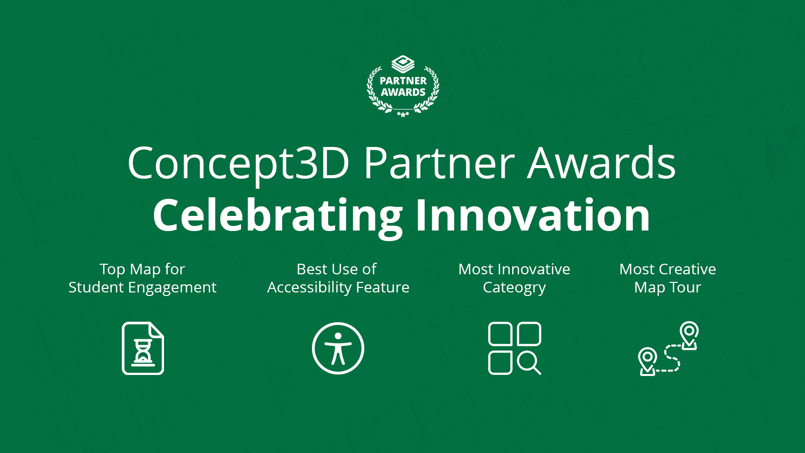
We’re proud to celebrate the 2025 Interactive Map Partner Award winners.
🏆 Most Creative Map Tour
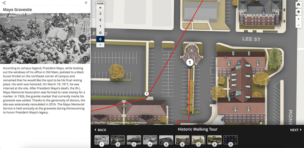
East Texas A&M University
East Texas A&M University sets a new bar for what Map Tours can achieve as both a storytelling and self-guided exploration tool. Their team has thoughtfully designed multiple tours that allow users to engage with campus history, culture, and identity—on their own time and at their own pace.
Two standout examples include the Meaningful Moments Tour and the Historic Walking Tour, both of which demonstrate how tours can go beyond logistics to tell rich, narrative-driven campus stories. These tours invite users to slow down, explore intentionally, and develop a deeper connection to place—whether they’re visiting in person or engaging remotely.
What makes East Texas A&M’s approach exceptional is the balance between structure and flexibility. Users are guided, but never constrained—making the experience feel personal, accessible, and engaging. It’s a powerful example of how Map Tours can support admissions, alumni engagement, and campus storytelling alike.
🏆 Most Innovative Map Category
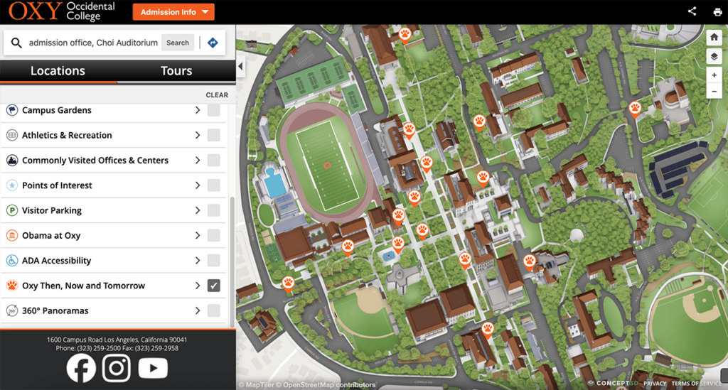
Occidental College
Occidental College earned recognition for its “Oxy Then and Now” map category—an innovative use of categorization to showcase the evolution of campus spaces over time.
This category allows users to explore how buildings and locations have changed, blending historical context with present-day navigation. It’s a compelling example of how map categories can be used not just to organize locations, but to tell a visual, temporal story about institutional growth and transformation.
By pairing past and present, Occidental demonstrates how Interactive Maps can support alumni engagement, campus pride, and historical preservation—while still serving practical wayfinding needs. It’s a creative, forward-thinking use of categories that reimagines what a campus map can communicate.
🏆 Top Map for Student Engagement
Lakeland University
Lakeland University’s Interactive Map stands out for its strategic focus on student engagement and recruitment, particularly through the use of 360° map experiences.
By opting into the 360 Map with immersive imagery, Lakeland created a digital showcase of campus spaces designed to capture attention and encourage exploration. The team has invested significant effort into using the map as a recruitment tool for 2026—especially to attract out-of-state prospective students who may not be able to visit campus in person.
Their goals are clear and intentional:
- Increase prospective student engagement
- Support new resident navigation
- Boost enrollment through immersive digital experiences
Lakeland’s map demonstrates how Interactive Maps can play a meaningful role in the enrollment funnel—bridging the gap between curiosity and commitment through visual, self-guided exploration.

🏆 Best Use of Accessible Features
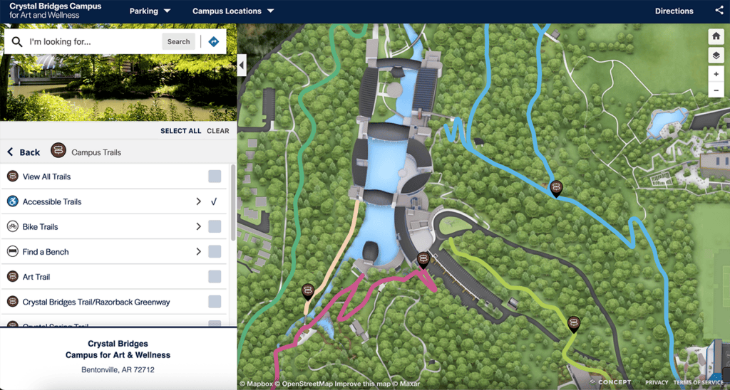
Crystal Bridges Campus for Art and Wellness
Crystal Bridges Campus for Art and Wellness exemplifies accessibility-first design through its “Access for All” mission, making inclusivity the foundation of its Interactive Map experience.
From thoughtful font sizing and clear categories to intentional keyword usage that enables bilingual search, the team has prioritized usability for visitors of all abilities. Accessibility is woven throughout the map—not siloed into a single feature.
Standout elements include:
- Accessible Trails and “Find a Bench” categories within walking routes
- ADA and accessible locations embedded across multiple categories
- Clear, intuitive navigation that reduces friction for all users
This approach ensures visitors can explore the campus confidently and comfortably, reinforcing the idea that accessibility benefits everyone. Crystal Bridges’ map is a powerful example of how Interactive Maps can support equity, wellness, and inclusion in real, practical ways.
Partner Innovation in Action
This year’s Interactive Map Partner Award winners show the incredible range of what’s possible with Concept3D Interactive Maps—from historical storytelling and immersive recruitment to accessibility-driven design.
We’re inspired by these partners and excited to see how they—and others—continue to innovate in the years ahead.Interested in seeing what’s possible with Interactive Maps?
Explore our gallery of partner maps or connect with our team to learn how Interactive Maps can support engagement, accessibility, and wayfinding across your campus or organization.