
Your school’s grads have worked hard for their Commencement Day. It’s an exciting time for schools, but it also means that your campus will be hosting the entire population of your senior class plus their families and maybe even a few others. It’s in the best interest of schools to make sure that their guests are able to navigate the campus with ease.
Between finding parking, attending the ceremony, and finding someplace to celebrate afterward, an interactive campus map is the perfect solution for getting your campus ready and showing off a little in the process. Here are a few ways to make it all a success.
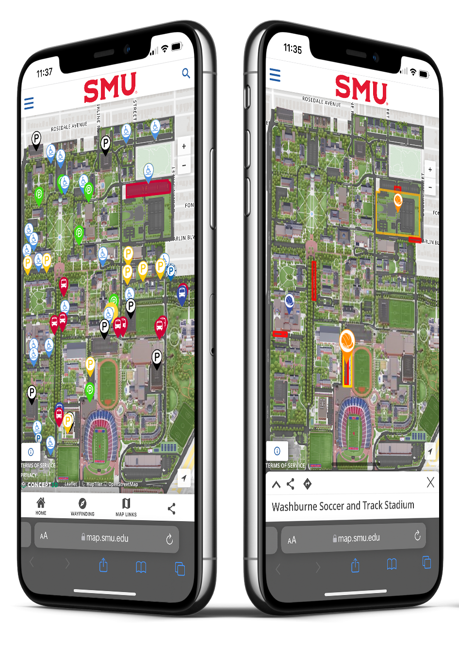 Add event-specific campus map layers
For graduation, guests will need guidance on where to find parking, the best walking routes, event locations and dining spots. Concept3D’s interactive mapping software allows you to add specific layers for certain events, including graduation. These layers highlight points of importance on days leading up to the event, as well as during and after the event itself, and the user can toggle them on and off easily. Going beyond graduation, the layer function can be applied to accommodate other events as well, such as game days, move-in and move-out days, orientation, and much more.
Use the print map module for hard copies
In addition to providing guests with a digital and mobile-friendly interactive campus map, offering physical maps is always a great option. The Concept3D Print Maps feature offers the ability to produce physical copies of your campus map, as well as to allow online visitors to print specific areas depending on their needs. For example, someone might just want to see how to get from parking to the graduation ceremony area. The Print Map module automatically does all the formatting, so you don’t need to waste any time or resources developing your own map to print and hand out. Develop a print-ready map, and share the link to that in a specific page, email or other communications avenue.
To learn more about how you can use the Print Map module, click here.
ESRI technology helps behind the scenes
Graduation requires much more work than simply ensuring that all of your guests end up in the right place. There’s a lot of work that goes on behind the scenes. Administration and facilities managers’ responsibilities include providing seating, cleaning up campus, coordinating the events and serving food. Concept3D’s solutions integrate with ESRI technology to help facility managers and event planners use the features of an all-in-one interactive map. ESRI technology can keep track of garbage pickup so you can stay ahead of any unsightly trash overflow. It can be used to coordinate the event by highlighting the walking path that your faculty and grads will take before receiving degrees, which will do wonders in preventing confusion come event-time.
To learn more about how Concept3D uses ESRI technology to produce the most powerful campus maps, click here.
 Tie in your event marketing with Localist integration
Concept3D partners with Localist, an events marketing system, to help students navigate campus during events more easily. Instead of pulling a Google Map into your Localist event listings, you can embed specific areas from your Concept3D Interactive Map. This makes it easier for guests to visualize the location and find their way around, and also makes your event marketing easier by driving everything through Localist. Guests can also explore the campus through the Localist-integrated 3D map, and see parking, off-campus amenities, and other points of interest.
Commencement is a perfect opportunity for your school to celebrate graduating students and ensure that guests have a favorable experience during their visit. But it’s also an ideal time to put your campus on display.
Want to learn more about Interactive Maps? Check out this pre-recorded demo to see what all you can achieve with an intuitive virtual solution.